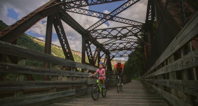
Great Allegany Passage

- Difficulty
- Moderate
- Distance
- 23 ml
- Duration
- 2 hr
- Ascent
- 2 ft
- Descent
- 2 ft
Chosen by National Geographic as one of the "Top Fall Trips In The World," the Great Allegheny Passage winds through Maryland's mountains and along Wills Creek, giving bicyclists, hikers, and cross-country skiers some of the most majestic views in the east. Linking up to the C&O Canal Towpath in Cumberland, Maryland, travelers can enjoy a continuous, off-road trail experience for 334 miles from Pittsburgh, Pennsylvania, to Washington, D.C. Starting in Cumberland, the Great Allegheny Passage follows the route of the historic Western Maryland Railway as it makes a gradual ascent to the Eastern Continental Divide. Along the way, travelers pass through the Brush Tunnel and bend around Helmstetter's Curve, paralleling the Western Maryland Scenic Railroad. After Frostburg, travelers can meander through the Borden Tunnel, cross the Mason & Dixon Line, and catch spectacular views into four states at the overlook outside the lighted Big Savage Tunnel.
The trail surface is mostly packed, crushed limestone, with the section near Cumberland, paved with asphalt. This trail is suitable for most types of bicycle, from mountain bikes and hybrids to road bikes.
Allegany County Trail Access and Parking:
Frostburg Riley Trail Access - New Hope Road NW, Frostburg, MD (Mile Marker 16)
Woodcock Hollow Trail Access - Mt Savage, MD 21545 (Mile Marker 9.6)
Cash Valley Road Trail Access - Cash Valley Road, LaVale, MD 21502 (Mile Marker 5.2)
Cumberland Trail Access - 13 Canal Street, Cumberland, MD (Mile Marker 0)